About these landscapes
Royal Air Force Station Hornchurch (RAF Hornchurch) was an airfield located in Hornchurch. Originally the airfield was built on Suttons Farm in the First World War because it was strategically placed to help protect London from enemy airships and bombers.
Whilst the area is now public parkland, some clues of the airfield’s purpose were left behind. This page helps you to think like an archaeologist and identify these hidden military structures or remains in the landscape!
KEY FACTS
At the start of the 20th century, the military had the power to requisition land in the face and urgency of war. In early October 1915, after the outbreak of the First World War, the 90 acres of Sutton Farm was officially claimed for military use because of its useful location, and a new squadron- the Royal Flying Corps-were based there.
In the 2nd World War, the pilots based at RAF Hornchurch aided rescues during the Battle of Dunkirk in June 1940 and later took part in Battle of Britain in July the same year.
After the wars, RAF Hornchurch was used as a training facility for new cadets and as depot until 1962. The site was then sold to Ford Motor Company as an overflow storage facility. In the 1970s, it was landscaped and turned into Hornchurch Country Park.
History:
Name that military structure!
Remains of the landscape’s past lie hidden in Hornchurch Country Park.
Take a look at these images and see if you can guess what their purpose was and what they are called:
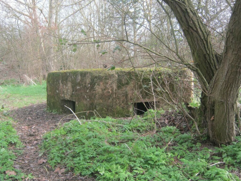
Submerged Pillbox at Hornchurch Country Park © A.K. Philpot
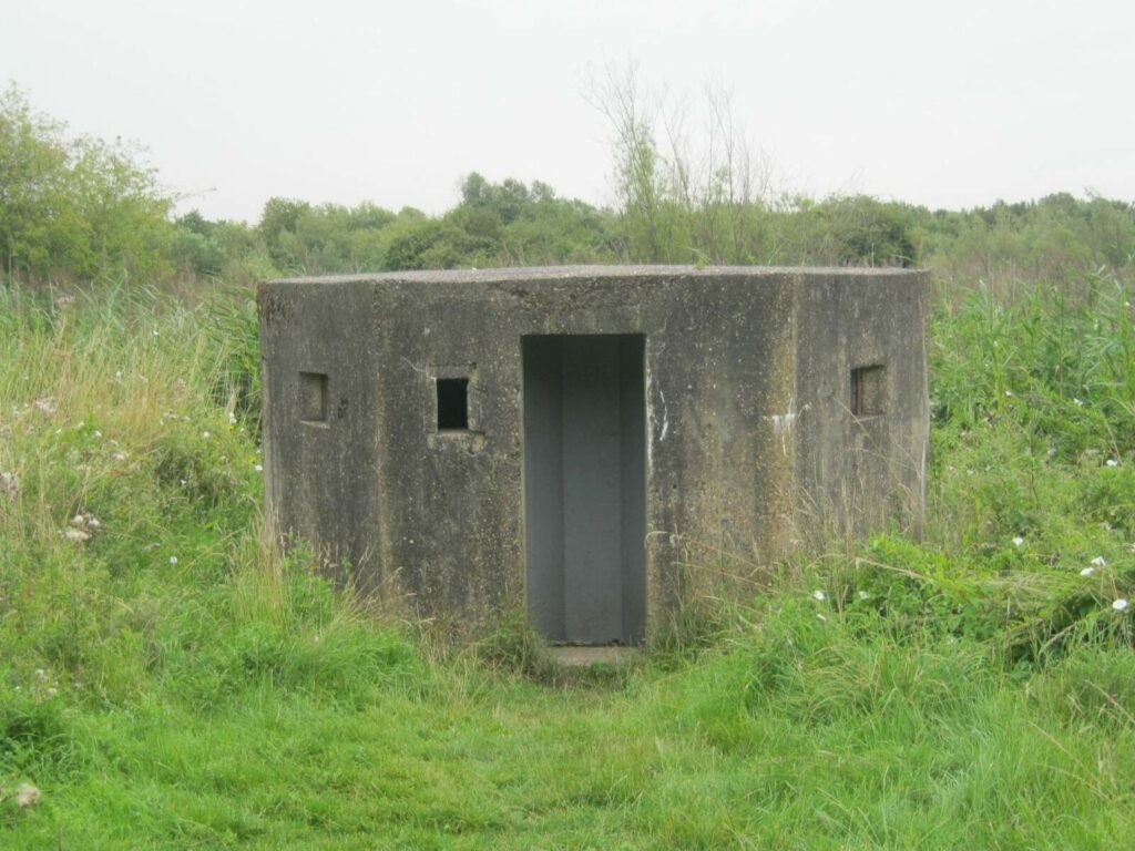
Pillbox at Hornchurch Country Park © A.K. Philpot
These look like little houses…but are those really windows?
Answer: The PILLBOX is one of the most common leftover feature in military landscapes
across the world. They are tough concrete shelters which help to protect those inside
from grenades and bullets. They are often strategically placed to gain an advantage over
the enemy.
The ‘windows’ were in fact for firing out of and to see what the enemy was doing.
28,000 pillboxes were created in Britain in preparation so the 2nd World War. 6,500 of
these still remain scattered in the landscape.
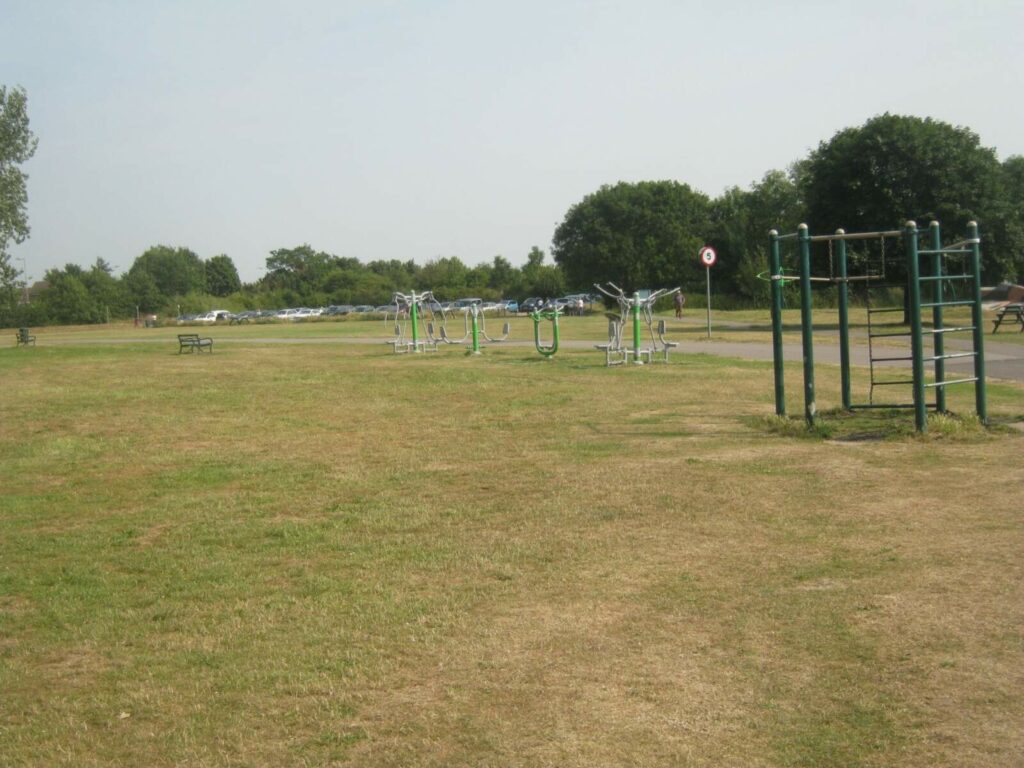
Outdoor gym at Hornchurch Country Park © A.K. Philpot
This landscape looks quite flat doesn’t it? So what could have been here? Answer: Airfields need to be really flat to make it easier for planes to land! There would have been several flight paths, which would have been used according to wind direction.
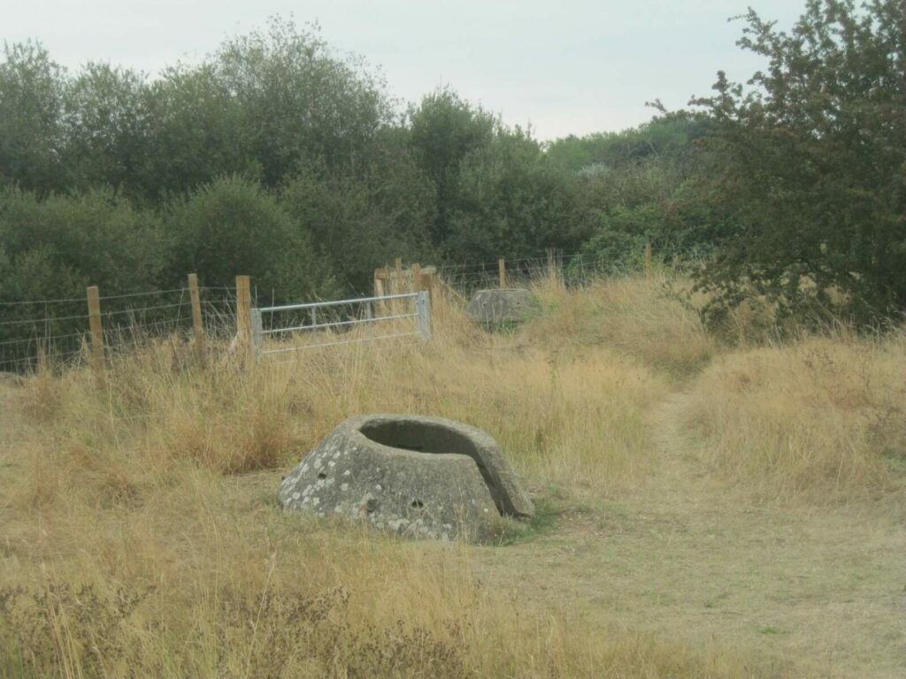
Tett Turret 1 at Hornchurch Country Park © A.K. Philpot
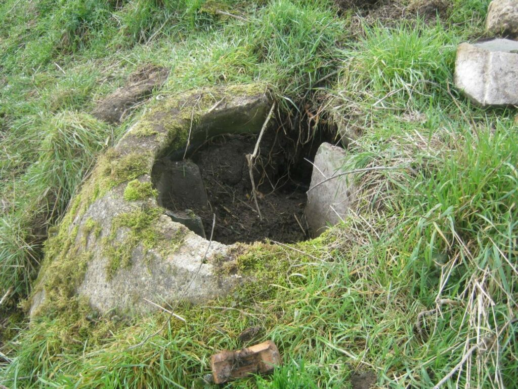
Tett Turret2 at Hornchurch Country Park © A.K. Philpot
What about these 2 round structures? What were they used for?
Answer: these are TETT TURRETS, essentially a smaller form of pillbox. They are made of strong concrete and steel which can protect a group of soldiers from bullets and shrapnel. A Tett turret can also be ‘swivelled’ and moved sideways by the people inside, who could then fire over the top. It was favoured because it gave more opportunity to fire weapons out than pillboxes and was also easier to ‘hide’ within the landscape. Clues in the landscape.
Look at the photograph below. Was this a place to turn a plane around? Or a compass to show which way was north? Or a gun post? Why not try to investigate why a circle would have been useful at an airfield?!
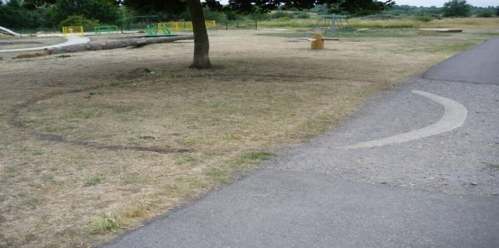
Remains of a gun post at Hornchurch Country Park © A.K. Philpot
What’s in a name . . .
Many place names in the Hornchurch area are adopted or inspired by the names of
pilots or the airfield.
- There is a primary school in Hornchurch called the R.J Mitchell School which is named
after the man who designed the Supermarine Spitfire, but interestingly it was also built
on the RAF Hornchurch’s former parade ground in 1968. - A secondary school formerly known as Suttons Senior School (after the original farm)
was renamed Sanders Draper School in 1973, to commemorate the sacrifice made by
the American pilot, Flying Officer Raimund (Smudge) Sanders Draper, to save the
school in March 1943. His plane’s engine cut out on take-off and Sanders Draper
purposely crashed his Spitfire plane into a field, dying in the process, to avoid hitting
the school and harming the children within. - Tangmere Crescent: RAF Tangmere was another important airfield located in Chichester- where the famous pilot Douglas Badar was based.
Question: Are there any roads or buildings near you that might have a military background?
Where does you school’s name come from?
How would you find out?
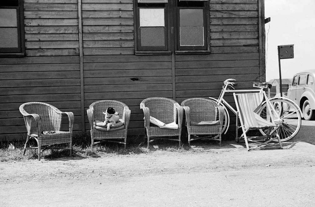
Empty chairs and parked bicycles leaning against a dispersal hut at Hornchurch aerodrome, 7 May 1942, with the dog waiting patiently for its master to return from a flight. © Public Domain
